
JewishGen Research Divisions:
Austria-Czech Research Division |
French Research Division |
German-Jewish Research Division |
Maps covering the central European Region
“The Comprehensive Atlas and Geography of the World”
published 1882 by Blackie and Sons, Edinburgh, Scotland:
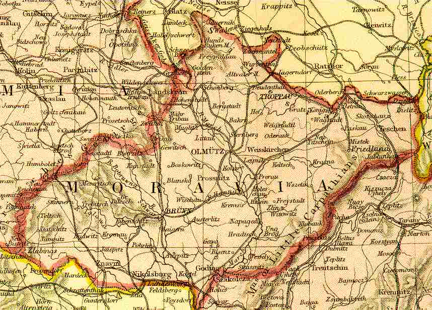
Moravia - Austro-Hungarian Empire 1882
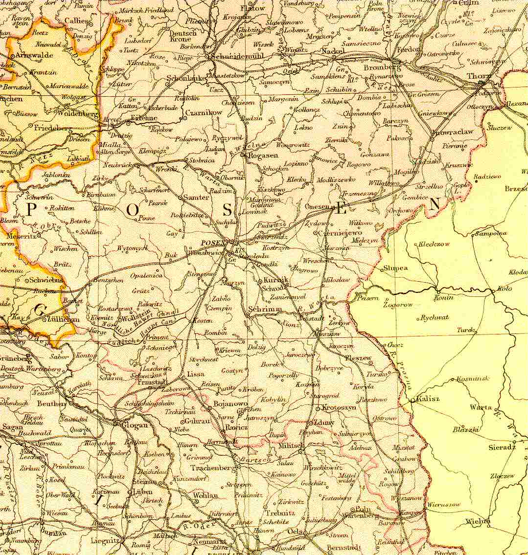
Posen-Prussia - German Empire East 1882
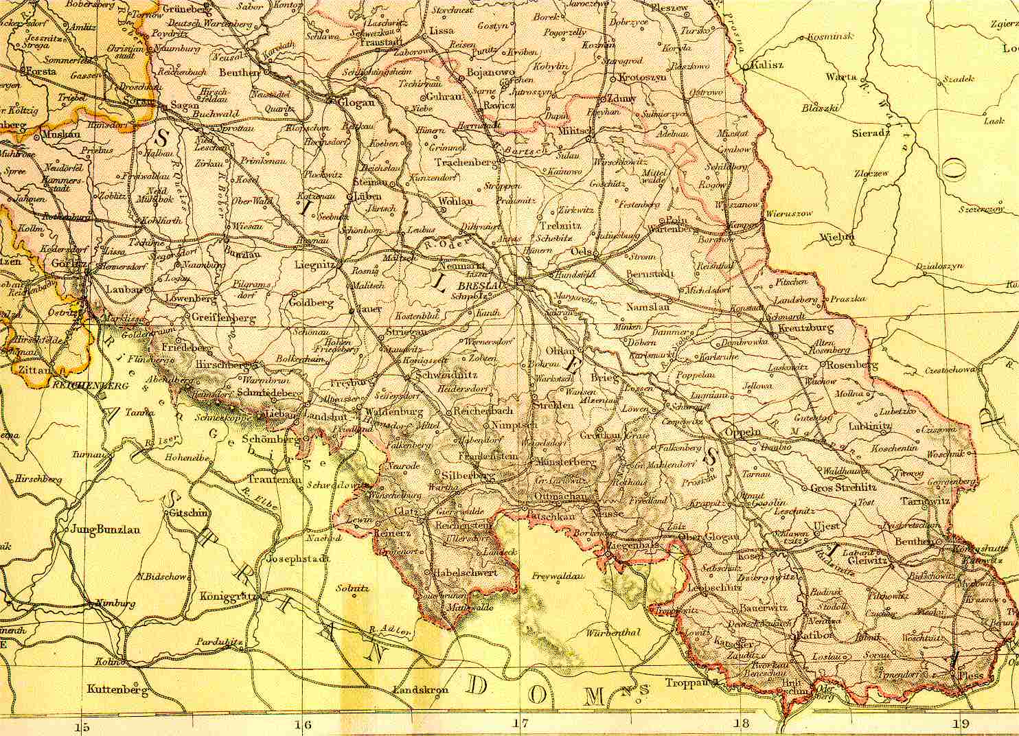
Silesia-Prussia - German Empire East 1882
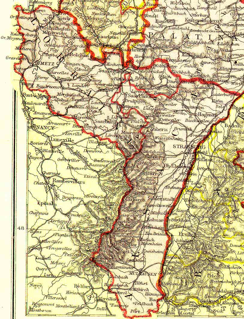
Alsace-Lorraine - German Empire West 1882
KehilaLinks Home | More about KehilaLinks | Contact KehilaLinks Coordinators | JewishGen home page